
Thank you for supporting this site ❤️
Make a donation
Make a donation
Gear up for your next adventure:
As an Amazon Associate, this site earns from qualifying purchases at no extra cost to you.
Semberg topographic map
Click on the map to display elevation.
Thank you for supporting this site ❤️
Make a donation
Make a donation
Gear up for your next adventure:
As an Amazon Associate, this site earns from qualifying purchases at no extra cost to you.
About this map
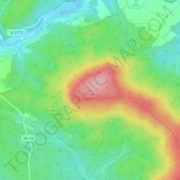
Name: Semberg topographic map, elevation, terrain.
Location: Semberg, Landkreis Bamberg, Bayern, 96148, Deutschland (49.96320 10.82745 49.96330 10.82755)
Average elevation: 311 m
Minimum elevation: 254 m
Maximum elevation: 407 m
Thank you for supporting this site ❤️
Make a donation
Make a donation
Gear up for your next adventure:
As an Amazon Associate, this site earns from qualifying purchases at no extra cost to you.