Geolocate

Ayamachay topographic map

Click on the map to display elevation.

About this map

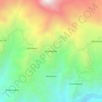
Name: Ayamachay topographic map, elevation, terrain.

Location: Ayamachay, Incahuasi, Ferreñafe, Lambayeque, Perú (-6.24325 -79.39888 -6.20325 -79.35888)

Average elevation: 2,825 m

Minimum elevation: 2,178 m

Maximum elevation: 3,764 m

Gear up for your next adventure:

🧦Merino Wool Socks - Moisture-wicking comfort for long-distance hiking
🔋Lithium AA Batteries - Long-lasting power that performs in extreme cold
🧣Merino Neck Gaiter - Protects against wind, sun, and cold at high altitudes
🥾Waterproof Trail Shoes - Shoes designed to handle wet terrain
🧭GPS Handheld Device - Reliable GPS navigation for outdoor adventures

As an Amazon Associate, this site earns from qualifying purchases at no extra cost to you.