Geolocate

Huambo topographic map

Click on the map to display elevation.

About this map

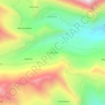
Name: Huambo topographic map, elevation, terrain.

Location: Huambo, Pacobamba, Andahuaylas, Apurímac, Perú (-13.60387 -73.11744 -13.56387 -73.07744)

Average elevation: 2,971 m

Minimum elevation: 2,459 m

Maximum elevation: 3,629 m

Gear up for your next adventure:

🪑Insulated Seat Pad - Protect your seat from cold rocks and wet logs
👟Leg Gaiters - Keep debris, mud, and snow out of your boots
🔋Emergency Crank Radio - Weather alerts and power without needing batteries
🧭GPS Handheld Device - Reliable GPS navigation for outdoor adventures
💡Compact LED Flashlight - Powerful and portable flashlight for outdoor use

As an Amazon Associate, this site earns from qualifying purchases at no extra cost to you.