
Thank you for supporting this site ❤️
Make a donation
Make a donation
Gear up for your next adventure:
As an Amazon Associate, this site earns from qualifying purchases at no extra cost to you.
Yanayaku topographic map
Click on the map to display elevation.
Thank you for supporting this site ❤️
Make a donation
Make a donation
Gear up for your next adventure:
As an Amazon Associate, this site earns from qualifying purchases at no extra cost to you.
About this map
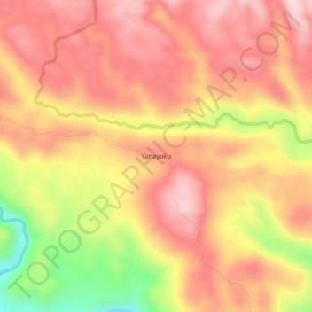
Name: Yanayaku topographic map, elevation, terrain.
Location: Yanayaku, Cotundo, Archidona, Napo, Ecuador (-0.80122 -77.77369 -0.76122 -77.73369)
Average elevation: 1,018 m
Minimum elevation: 813 m
Maximum elevation: 1,132 m
Thank you for supporting this site ❤️
Make a donation
Make a donation
Gear up for your next adventure:
As an Amazon Associate, this site earns from qualifying purchases at no extra cost to you.