
Thank you for supporting this site ❤️
Make a donation
Make a donation
Gear up for your next adventure:
As an Amazon Associate, this site earns from qualifying purchases at no extra cost to you.
6071 topographic map
Click on the map to display elevation.
Thank you for supporting this site ❤️
Make a donation
Make a donation
Gear up for your next adventure:
As an Amazon Associate, this site earns from qualifying purchases at no extra cost to you.
About this map
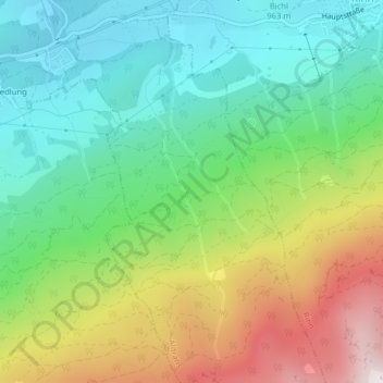
Name: 6071 topographic map, elevation, terrain.
Location: 6071, Aldrans, Bezirk Innsbruck-Land, Tirol, Österreich (47.23632 11.48521 47.23642 11.48531)
Average elevation: 1,272 m
Minimum elevation: 864 m
Maximum elevation: 2,029 m
Thank you for supporting this site ❤️
Make a donation
Make a donation
Gear up for your next adventure:
As an Amazon Associate, this site earns from qualifying purchases at no extra cost to you.