
Thank you for supporting this site ❤️
Make a donation
Make a donation
Gear up for your next adventure:
As an Amazon Associate, this site earns from qualifying purchases at no extra cost to you.
Beersel topographic map
Click on the map to display elevation.
Thank you for supporting this site ❤️
Make a donation
Make a donation
Gear up for your next adventure:
As an Amazon Associate, this site earns from qualifying purchases at no extra cost to you.
About this map
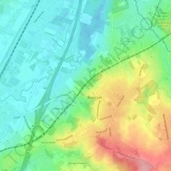
Name: Beersel topographic map, elevation, terrain.
Location: Beersel, Hal-Vilvorde, Brabant flamand, Flandre, 1650, Belgique (50.75477 4.28434 50.78219 4.33875)
Average elevation: 55 m
Minimum elevation: 16 m
Maximum elevation: 131 m
Thank you for supporting this site ❤️
Make a donation
Make a donation
Gear up for your next adventure:
As an Amazon Associate, this site earns from qualifying purchases at no extra cost to you.