Geolocate

El Tanque topographic map

Click on the map to display elevation.

About this map

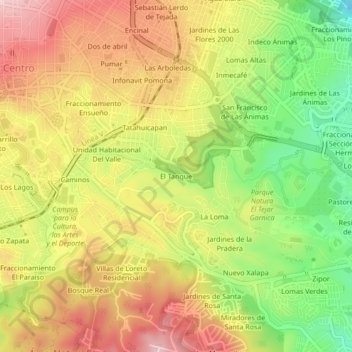
Name: El Tanque topographic map, elevation, terrain.

Location: El Tanque, Xalapa, Veracruz, 91065, Mexico (19.49751 -96.92272 19.53751 -96.88272)

Average elevation: 1,341 m

Minimum elevation: 1,209 m

Maximum elevation: 1,457 m

Gear up for your next adventure:

🥾Light Trekking Boots - Supportive boots for multi-day treks
🧊Portable Cooler - Keep food and drinks cold during outdoor adventures
🧢Hiking Sun Hat - Wide-brimmed protection for exposed mountain ridges
🎒Hiking Daypack - Lightweight and durable backpacks for day trips and excursions
🧤Rechargeable Heated Gloves - Extreme warmth for Canadian winter expeditions

As an Amazon Associate, this site earns from qualifying purchases at no extra cost to you.