
Thank you for supporting this site ❤️
Make a donation
Make a donation
Gear up for your next adventure:
As an Amazon Associate, this site earns from qualifying purchases at no extra cost to you.
Claret topographic map
Click on the map to display elevation.
Thank you for supporting this site ❤️
Make a donation
Make a donation
Gear up for your next adventure:
As an Amazon Associate, this site earns from qualifying purchases at no extra cost to you.
About this map
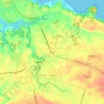
Name: Claret topographic map, elevation, terrain.
Location: Claret, Le Moule, Pointe-à-Pitre, Guadeloupe, 97160, France (16.28989 -61.33520 16.32989 -61.29520)
Average elevation: 27 m
Minimum elevation: -1 m
Maximum elevation: 46 m
Thank you for supporting this site ❤️
Make a donation
Make a donation
Gear up for your next adventure:
As an Amazon Associate, this site earns from qualifying purchases at no extra cost to you.