Geolocate

Caledonia Township topographic map

Click on the map to display elevation.

About this map

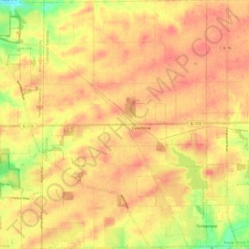
Name: Caledonia Township topographic map, elevation, terrain.

Location: Caledonia Township, Boone County, Illinois, United States (42.32665 -88.94033 42.41469 -88.86120)

Average elevation: 280 m

Minimum elevation: 237 m

Maximum elevation: 300 m

Other topographic maps

Click on a map to view its topography, its elevation and its terrain.

Garden Prairie

United States > Illinois > Boone County

Average elevation: 240 m

Gear up for your next adventure:

💡LED Camping Lantern - Illuminate your campsite with long-lasting lanterns
💧Filtered Water Bottle - Safe drinking water on the go
🥾Trail Running Boots - Durable shoes designed for trail running
🔦LED Headlamp - Hands-free lighting for early morning starts or late finishes
🛶Canoe Life Vest - Safety vest for water sports

As an Amazon Associate, this site earns from qualifying purchases at no extra cost to you.