Geolocate

Guiteb topographic map

Click on the map to display elevation.

About this map

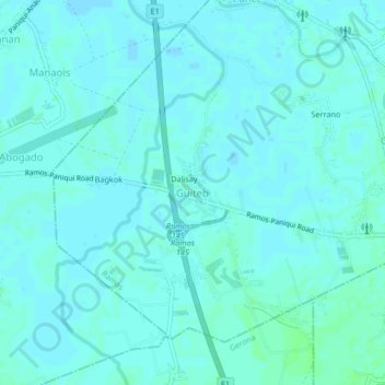
Name: Guiteb topographic map, elevation, terrain.

Location: Guiteb, Ramos, Tarlac, Central Luzon, 2311, Philippines (15.64859 120.59625 15.68859 120.63625)

Average elevation: 18 m

Minimum elevation: 16 m

Maximum elevation: 22 m

Gear up for your next adventure:

🧴Outdoor Sunscreen - High SPF protection for high-altitude UV exposure
Lightweight Camping Tent - Portable shelter optimized for Canadian backcountry camping
🧣Evaporative Cooling Towel - Beat the heat during intense summer climbs
🥫Freeze-Dried Meals - Lightweight, high-calorie nutrition for multi-day treks
🧭Orienteering Kit - Tools for map reading and navigation in the wild

As an Amazon Associate, this site earns from qualifying purchases at no extra cost to you.