Geolocate

La Busta topographic map

Click on the map to display elevation.

About this map

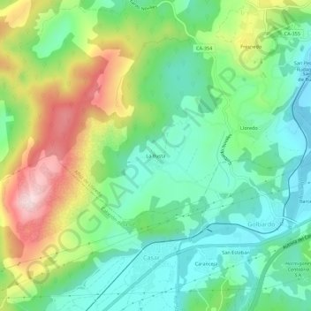
Name: La Busta topographic map, elevation, terrain.

Location: La Busta, Alfoz de Lloredo, Cantabria, 39590, España (43.32983 -4.19748 43.36983 -4.15748)

Average elevation: 175 m

Minimum elevation: 59 m

Maximum elevation: 396 m

Gear up for your next adventure:

🧢Hiking Sun Hat - Wide-brimmed protection for exposed mountain ridges
💡LED Camping Lantern - Illuminate your campsite with long-lasting lanterns
🔭Compact Monocular - One-handed bird watching and trail spotting
🧥Insulated Jacket - Keep warm in cold outdoor conditions
🚑Survival Whistle - Signal for help across long distances in mountains

As an Amazon Associate, this site earns from qualifying purchases at no extra cost to you.