Geolocate

Kilauea topographic map

Click on the map to display elevation.

About this map

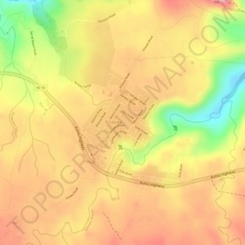
Name: Kilauea topographic map, elevation, terrain.

Location: Kilauea, Kauaʻi County, Hawaii, 96754, United States (22.19619 -159.42260 22.22117 -159.39268)

Average elevation: 89 m

Minimum elevation: 4 m

Maximum elevation: 133 m

Gear up for your next adventure:

🥫Freeze-Dried Meals - Lightweight, high-calorie nutrition for multi-day treks
🧥Softshell Jacket - Windproof and breathable jacket for hiking
🧥Waterproof Hiking Jacket - Protect yourself from rain and wind while hiking
Camping Essentials - All-in-one gear for a comfortable camping trip
🦟Insect Repellent - Keep mosquitoes and black flies away in wooded areas

As an Amazon Associate, this site earns from qualifying purchases at no extra cost to you.