Geolocate

El Rodadero topographic map

Click on the map to display elevation.

About this map

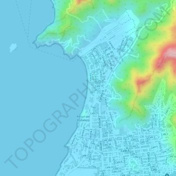
Name: El Rodadero topographic map, elevation, terrain.

Location: El Rodadero, Peñon del Rodadero, Localidad 3 Turística - Perla del Caribe, Perímetro Urbano Santa Marta, Santa Marta, Magdalena, RAP Caribe, Colombia (11.19788 -74.22934 11.20730 -74.22751)

Average elevation: 30 m

Minimum elevation: -1 m

Maximum elevation: 251 m

Other topographic maps

Click on a map to view its topography, its elevation and its terrain.

Gear up for your next adventure:

❄️Traction Ice Cleats - Slip-on spikes for icy trails and winter hiking
🥾Trekking Boots - Durable boots for long-distance trekking
🧢Outdoor Visor - Breathable visor for sunny hikes
🪑Insulated Seat Pad - Protect your seat from cold rocks and wet logs
👟Trail Running Shoes - Agile footwear for fast-paced topographic exploration

As an Amazon Associate, this site earns from qualifying purchases at no extra cost to you.