
Cantón topographic map
Interactive map
Click on the map to display elevation.
About this map
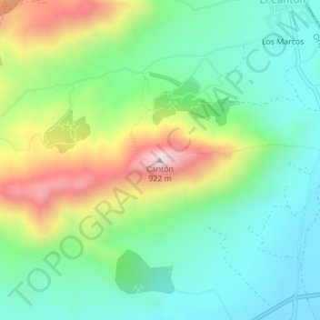
Name: Cantón topographic map, elevation, terrain.
Location: Cantón, Abanilla, Oriental, Region of Murcia, Spain (38.28790 -0.99573 38.28800 -0.99563)
Average elevation: 555 m
Minimum elevation: 386 m
Maximum elevation: 897 m