
Ponneri topographic map
Click on the map to display elevation.
Ponneri
Ponneri is located at 13°19′N 80°12′E / 13.32°N 80.2°E / 13.32; 80.2. It has an average elevation of 16 metres (52 feet).
About this map
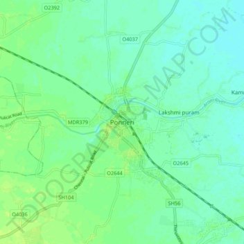
Name: Ponneri topographic map, elevation, terrain.
Location: Ponneri, Thiruvallur District, Tamil Nadu, 601204, India (13.29616 80.15483 13.37616 80.23483)
Average elevation: 10 m
Minimum elevation: 4 m
Maximum elevation: 16 m