Geolocate

Mentzer topographic map

Click on the map to display elevation.

About this map

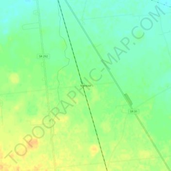
Name: Mentzer topographic map, elevation, terrain.

Location: Mentzer, Buck Township, Hardin County, Ohio, United States (40.57672 -83.60160 40.61672 -83.56160)

Average elevation: 307 m

Minimum elevation: 293 m

Maximum elevation: 322 m

Other topographic maps

Click on a map to view its topography, its elevation and its terrain.

Ada

United States > Ohio > Hardin County

Average elevation: 293 m

Alger

United States > Ohio > Hardin County

Average elevation: 304 m

Dunkirk

United States > Ohio > Hardin County

Average elevation: 287 m

Forest

United States > Ohio > Hardin County

Average elevation: 283 m

McGuffey

United States > Ohio > Hardin County

Average elevation: 296 m

Mount Victory

United States > Ohio > Hardin County

Average elevation: 317 m

Patterson

United States > Ohio > Hardin County

Average elevation: 281 m

Ridgeway

United States > Ohio > Hardin County

Average elevation: 323 m

Buck Township

United States > Ohio > Hardin County

Average elevation: 303 m

Gear up for your next adventure:

🌬️Windproof Camp Stove - Efficient cooking even on exposed mountain peaks
🛶Canoe Life Vest - Safety vest for water sports
💡Compact LED Flashlight - Powerful and portable flashlight for outdoor use
💡LED Headlamp - Hands-free illumination for night hiking and camping
🧥Thermal Layer - Insulating layer for cold outdoor conditions

As an Amazon Associate, this site earns from qualifying purchases at no extra cost to you.