Geolocate

Lhodrak topographic map

Click on the map to display elevation.

About this map

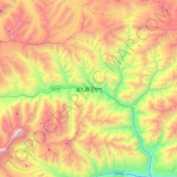
Name: Lhodrak topographic map, elevation, terrain.

Location: Lhodrak, Lhozhag, Lhodrak County, Lhoka, Tibet, China (28.22931 90.69878 28.54931 91.01878)

Average elevation: 4,789 m

Minimum elevation: 3,331 m

Maximum elevation: 6,452 m

Gear up for your next adventure:

💧Hydration Pack - Hands-free hydration system for long hikes
🧴Bear Spray Holster - Quick-access carry for essential Canadian wilderness safety
🥾Light Hiking Boots - Lightweight and comfortable boots for day hikes
🧭Orienteering Kit - Tools for map reading and navigation in the wild
🛶Waterproof Dry Bags - Keep electronics and clothes dry during river crossings

As an Amazon Associate, this site earns from qualifying purchases at no extra cost to you.