Geolocate

Ando topographic map

Click on the map to display elevation.

About this map

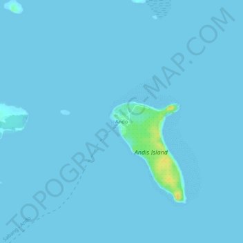
Name: Ando topographic map, elevation, terrain.

Location: Ando, Borongan, Eastern Samar, Eastern Visayas, Philippines (11.62392 125.45871 11.66392 125.49871)

Average elevation: 1 m

Minimum elevation: 0 m

Maximum elevation: 25 m

Gear up for your next adventure:

🥾Hiking Leggings - Comfortable leggings for outdoor activities
🥾Trail Hiking Boots - Supportive boots for rough trails
🐕Hiking Dog Pack - Let your canine companion carry their own water and food
🧦Hiking Liner Socks - Thin base layer to prevent friction and blisters
🧢Outdoor Cap - Protective cap for sun and rain during hikes

As an Amazon Associate, this site earns from qualifying purchases at no extra cost to you.