Geolocate

Basibé topographic map

Click on the map to display elevation.

About this map

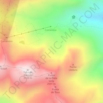
Name: Basibé topographic map, elevation, terrain.

Location: Basibé, Montanuy, La Ribagorza, Aragón, España (42.53568 0.59658 42.55568 0.61658)

Average elevation: 2,232 m

Minimum elevation: 1,723 m

Maximum elevation: 2,674 m

Gear up for your next adventure:

🧥Packable Rain Jacket - Breathable waterproof layer for unpredictable weather
🧥Thermal Layer - Insulating layer for cold outdoor conditions
🚲MTB Frame Bag - Carry tools and maps directly on your bicycle frame
🏕️Camping Hammock - Integrated protection for sleeping between trees
🧴Sunscreen SPF - Broad-spectrum sunscreen for outdoor activities

As an Amazon Associate, this site earns from qualifying purchases at no extra cost to you.