
Make a donation
Gear up for your next adventure:
As an Amazon Associate, this site earns from qualifying purchases at no extra cost to you.
Daiano topographic map
Click on the map to display elevation.
Make a donation
Gear up for your next adventure:
As an Amazon Associate, this site earns from qualifying purchases at no extra cost to you.
About this map
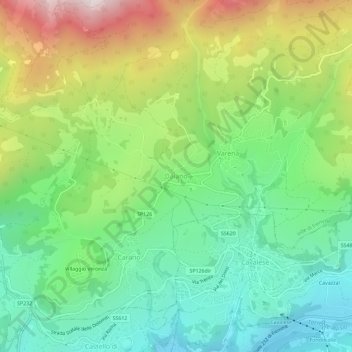
Name: Daiano topographic map, elevation, terrain.
Average elevation: 1,211 m
Minimum elevation: 837 m
Maximum elevation: 1,886 m
Make a donation
Gear up for your next adventure:
As an Amazon Associate, this site earns from qualifying purchases at no extra cost to you.
Other topographic maps
Click on a map to view its topography, its elevation and its terrain.
Castello Tesino
Italy > Trentino – Alto Adige/Südtirol > Provincia di Trento
Average elevation: 1,350 m
Telve di Sopra
Italy > Trentino – Alto Adige/Südtirol > Provincia di Trento
Average elevation: 1,228 m
Make a donation
Gear up for your next adventure:
As an Amazon Associate, this site earns from qualifying purchases at no extra cost to you.