Geolocate

97799 topographic map

Click on the map to display elevation.

About this map

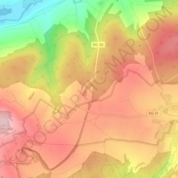
Name: 97799 topographic map, elevation, terrain.

Location: 97799, Zeitlofs, Landkreis Bad Kissingen, Bayern, Deutschland (50.25171 9.70459 50.25181 9.70469)

Average elevation: 388 m

Minimum elevation: 241 m

Maximum elevation: 478 m

Gear up for your next adventure:

🥾Hiking Shorts - Breathable shorts suitable for summer hikes
Camping Essentials - All-in-one gear for a comfortable camping trip
🧣Evaporative Cooling Towel - Beat the heat during intense summer climbs
🛌Down Sleeping Bag - Superior warmth-to-weight ratio for cold nights
🧢Sun Protection Cap - Breathable cap to protect from sun exposure

As an Amazon Associate, this site earns from qualifying purchases at no extra cost to you.