Geolocate

Bono topographic map

Click on the map to display elevation.

About this map

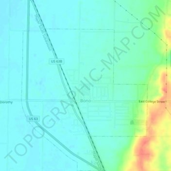
Name: Bono topographic map, elevation, terrain.

Location: Bono, Craighead County, Arkansas, United States (35.89421 -90.81536 35.93002 -90.78270)

Average elevation: 86 m

Minimum elevation: 74 m

Maximum elevation: 126 m

Other topographic maps

Click on a map to view its topography, its elevation and its terrain.

Gear up for your next adventure:

💧Hydration Pack - Hands-free hydration system for long hikes
🛰️Satellite Messenger - Emergency communication for areas with no cell service
💧Filtered Water Bottle - Safe drinking water on the go
🔨Vehicle Emergency Tool - Safety tool for remote road trips to trailheads
🎒Backpack Rain Cover - External shield to keep your entire pack dry

As an Amazon Associate, this site earns from qualifying purchases at no extra cost to you.