
تحصیل مستوج topographic map
Interactive map
Click on the map to display elevation.
About this map
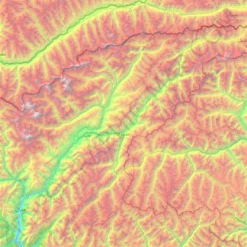
Name: تحصیل مستوج topographic map, elevation, terrain.
Average elevation: 4,143 m
Minimum elevation: 1,426 m
Maximum elevation: 7,626 m
Other topographic maps
Click on a map to view its topography, its elevation and its terrain.
Chitrâl
Pakistan > Khyber Pakhtunkhwa > District de Chitrâl
Chitrâl, تحصیل چترال, District du Bas Chitrâl, District de Chitrâl, Division de Malakand, Khyber Pakhtunkhwa, Pakistan
Average elevation: 2,982 m