
Thank you for supporting this site ❤️
Make a donation
Make a donation
Gear up for your next adventure:
As an Amazon Associate, this site earns from qualifying purchases at no extra cost to you.
Jamta topographic map
Click on the map to display elevation.
Thank you for supporting this site ❤️
Make a donation
Make a donation
Gear up for your next adventure:
As an Amazon Associate, this site earns from qualifying purchases at no extra cost to you.
About this map
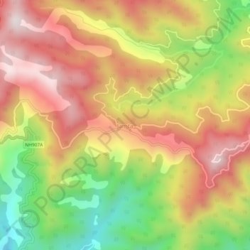
Name: Jamta topographic map, elevation, terrain.
Location: Jamta, Nahan, Sirmaur, Himachal Pradesh, 173001, India (30.57967 77.29491 30.61967 77.33491)
Average elevation: 1,086 m
Minimum elevation: 685 m
Maximum elevation: 1,420 m
Thank you for supporting this site ❤️
Make a donation
Make a donation
Gear up for your next adventure:
As an Amazon Associate, this site earns from qualifying purchases at no extra cost to you.