Geolocate

Pret topographic map

Click on the map to display elevation.

About this map

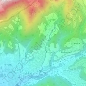
Name: Pret topographic map, elevation, terrain.

Location: Pret, Aprico, Fino del Monte, Bergamo, Lombardy, Italy (45.88980 9.98930 45.90980 10.00930)

Average elevation: 836 m

Minimum elevation: 620 m

Maximum elevation: 1,393 m

Gear up for your next adventure:

🦌Outdoor Trail Camera - Monitor wildlife activity near your favorite spots
🐕Hiking Dog Pack - Let your canine companion carry their own water and food
🛶Waterproof Dry Bags - Keep electronics and clothes dry during river crossings
🩹Compact First Aid Kit - Pre-packed essentials for common trail injuries
🧢Sun Hat - Wide-brim hat for sun protection

As an Amazon Associate, this site earns from qualifying purchases at no extra cost to you.