
Horsham topographic map
Click on the map to display elevation.
Horsham
Horsham's topography is flat, approximately 128 metres (420 ft) above sea level. The central business district (CBD) is laid out in a grid plan south of the train line and is characterised by wide streets and several roundabouts. Firebrace Street, running north–south through the middle of the CBD is one of Horsham's original "thoroughfares" (first surveyed in 1849) and is named after a soldier from the British Army, Major William Firebrace (1795-1856). Residential areas extend north of the train line, west towards Natimuk and south-west towards Haven and south-east across Burnt Creek. A light industrial area is located south of the Wimmera River.
About this map
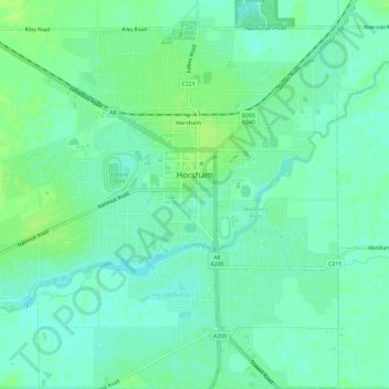
Name: Horsham topographic map, elevation, terrain.
Location: Horsham, Rural City of Horsham, Victoria, 3400, Australia (-36.74099 142.16871 -36.69353 142.22370)
Average elevation: 129 m
Minimum elevation: 123 m
Maximum elevation: 135 m
Other topographic maps
Click on a map to view its topography, its elevation and its terrain.