Geolocate

Dubuque topographic map

Click on the map to display elevation.

About this map

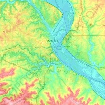
Name: Dubuque topographic map, elevation, terrain.

Location: Dubuque, Dubuque County, Iowa, United States (42.40926 -90.82401 42.55790 -90.63673)

Average elevation: 241 m

Minimum elevation: 178 m

Maximum elevation: 353 m

Gear up for your next adventure:

🔋Emergency Crank Radio - Weather alerts and power without needing batteries
🔥Camping Stove - Portable stoves to cook outdoors with ease
🥾Trail Running Shoes - Lightweight and durable shoes for trail running
💧Reusable Water Bottle - Durable water bottles for hydration on trails
🥾Hiking Leggings - Comfortable leggings for outdoor activities

As an Amazon Associate, this site earns from qualifying purchases at no extra cost to you.