Geolocate

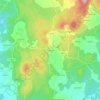
Puentecesures topographic map

Click on the map to display elevation.

Puentecesures

El relieve del municipio está definido por la ribera izquierda del río Ulla, que hace de límite con la provincia de La Coruña, y por los montes que se extienden al sur del río y que se adentran en el municipio de Valga. La altitud oscila entre los 370 metros al sureste, cerca del monte da Lagoa, y los 19 metros a orillas del río Ulla. La capital municipal, Infesta, se alza a 19 metros sobre el nivel del mar.

Wikipedia (CC-BY-SA 3.0)

About this map

Name: Puentecesures topographic map, elevation, terrain.

Location: Puentecesures, Caldas, Pontevedra, Galicia, 36640, España (42.70477 -8.66492 42.72915 -8.60430)

Average elevation: 86 m

Minimum elevation: -1 m

Maximum elevation: 365 m

Other topographic maps

Click on a map to view its topography, its elevation and its terrain.

Vilar de Mato

España > Galicia > Caldas > Cuntis

Average elevation: 411 m

Fervenza de Segade

España > Galicia > Caldas > Caldas de Reis

Average elevation: 137 m

Vilameán

España > Galicia > Caldas > Cuntis

Average elevation: 225 m

Marán

España > Galicia > Caldas > Caldas de Reis

Average elevation: 93 m

Mesego

España > Galicia > Caldas > Cuntis

Average elevation: 405 m

Arcos da Condesa

España > Galicia > Caldas > Caldas de Reis

Average elevation: 103 m

Zo

España > Galicia > Caldas > Cuntis

Average elevation: 437 m

Paraimas

España > Galicia > Caldas

Average elevation: 84 m

Os Barreiros

España > Galicia > Caldas > Caldas de Reis

Average elevation: 86 m

Gear up for your next adventure:

🥾Approach Shoes - Shoes designed for climbing approaches and rugged trails
🐕Hiking Dog Pack - Let your canine companion carry their own water and food
🦌Outdoor Trail Camera - Monitor wildlife activity near your favorite spots
🥾Waterproof Trail Shoes - Shoes designed to handle wet terrain
🏕️Camping Hammock - Integrated protection for sleeping between trees

As an Amazon Associate, this site earns from qualifying purchases at no extra cost to you.