Geolocate

Pracchia topographic map

Click on the map to display elevation.

About this map

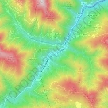
Name: Pracchia topographic map, elevation, terrain.

Location: Pracchia, Pistoia, Tuscany, Italy (44.03879 10.89145 44.07879 10.93145)

Average elevation: 837 m

Minimum elevation: 551 m

Maximum elevation: 1,200 m

Gear up for your next adventure:

🧥Waterproof Hiking Jacket - Protect yourself from rain and wind while hiking
🧥Thermal Fleece Jacket - Versatile insulation for changing mountain temperatures
👟Leg Gaiters - Keep debris, mud, and snow out of your boots
🧥Thermal Layer - Insulating layer for cold outdoor conditions
🛁Quick-Dry Microfiber Towel - Space-saving towel that dries rapidly on the move

As an Amazon Associate, this site earns from qualifying purchases at no extra cost to you.