
Thank you for supporting this site ❤️
Make a donation
Make a donation
Gear up for your next adventure:
As an Amazon Associate, this site earns from qualifying purchases at no extra cost to you.
Wölfis topographic map
Click on the map to display elevation.
Thank you for supporting this site ❤️
Make a donation
Make a donation
Gear up for your next adventure:
As an Amazon Associate, this site earns from qualifying purchases at no extra cost to you.
About this map
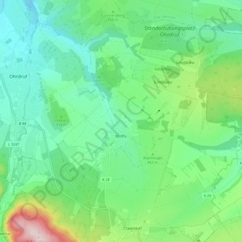
Name: Wölfis topographic map, elevation, terrain.
Location: Wölfis, Ohrdruf, Landkreis Gotha, Thüringen, Deutschland (50.78318 10.74524 50.84396 10.85992)
Average elevation: 443 m
Minimum elevation: 343 m
Maximum elevation: 723 m
Thank you for supporting this site ❤️
Make a donation
Make a donation
Gear up for your next adventure:
As an Amazon Associate, this site earns from qualifying purchases at no extra cost to you.