
Thank you for supporting this site ❤️
Make a donation
Make a donation
Gear up for your next adventure:
As an Amazon Associate, this site earns from qualifying purchases at no extra cost to you.
Pollung topographic map
Click on the map to display elevation.
Thank you for supporting this site ❤️
Make a donation
Make a donation
Gear up for your next adventure:
As an Amazon Associate, this site earns from qualifying purchases at no extra cost to you.
About this map
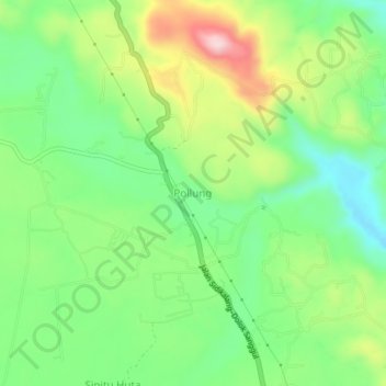
Name: Pollung topographic map, elevation, terrain.
Location: Pollung, Humbang Hasundutan, North Sumatra, Sumatra, Indonesia (2.28974 98.71415 2.32974 98.75415)
Average elevation: 1,408 m
Minimum elevation: 1,307 m
Maximum elevation: 1,575 m
Thank you for supporting this site ❤️
Make a donation
Make a donation
Gear up for your next adventure:
As an Amazon Associate, this site earns from qualifying purchases at no extra cost to you.