
Le Breuil topographic map
Interactive map
Click on the map to display elevation.
About this map
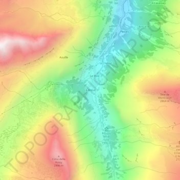
Name: Le Breuil topographic map, elevation, terrain.
Location: Le Breuil, Valsavarenche, Aosta Valley, Italy (45.50568 7.18119 45.54568 7.22119)
Average elevation: 2,421 m
Minimum elevation: 1,829 m
Maximum elevation: 3,135 m