Geolocate

Hantara topographic map

Click on the map to display elevation.

About this map

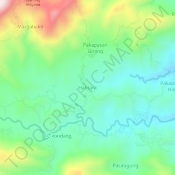
Name: Hantara topographic map, elevation, terrain.

Location: Hantara, Kuningan, West Java, Java, Indonesia (-7.07432 108.44251 -7.03432 108.48251)

Average elevation: 443 m

Minimum elevation: 263 m

Maximum elevation: 847 m

Other topographic maps

Click on a map to view its topography, its elevation and its terrain.

Gear up for your next adventure:

🧊Insulated Water Bottle - Keeps drinks cold in summer and prevents freezing in winter
🎒Fully Waterproof Backpack - Total protection for photography gear and electronics
🥾Mountain Hiking Boots - High-traction boots for rocky terrain
Lightweight Camping Tent - Portable shelter optimized for Canadian backcountry camping
🧴Waterproofing Spray - Restore the DWR coating on jackets and tents

As an Amazon Associate, this site earns from qualifying purchases at no extra cost to you.