Geolocate

Loceret topographic map

Click on the map to display elevation.

About this map

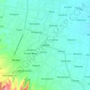
Name: Loceret topographic map, elevation, terrain.

Location: Loceret, Nganjuk, East Java, Java, 64471, Indonesia (-7.68684 111.85267 -7.60684 111.93267)

Average elevation: 69 m

Minimum elevation: 45 m

Maximum elevation: 186 m

Other topographic maps

Click on a map to view its topography, its elevation and its terrain.

Ngronggot

Indonesia > East Java > Nganjuk

Average elevation: 50 m

Kaloran

Indonesia > East Java > Nganjuk

Average elevation: 46 m

Ngronggot

Indonesia > East Java > Nganjuk

Average elevation: 51 m

Kelurahan

Indonesia > East Java > Nganjuk

Average elevation: 47 m

Banjarsari

Indonesia > East Java > Nganjuk

Average elevation: 49 m

Gear up for your next adventure:

Camping Tent - Weather-resistant tents suitable for 2 to 6 people
🥫Freeze-Dried Meals - Lightweight, high-calorie nutrition for multi-day treks
❄️Traction Ice Cleats - Slip-on spikes for icy trails and winter hiking
🧴First Aid Kit - Essential first aid supplies for outdoor emergencies
🧦Hiking Liner Socks - Thin base layer to prevent friction and blisters

As an Amazon Associate, this site earns from qualifying purchases at no extra cost to you.