Geolocate

Padaido topographic map

Click on the map to display elevation.

About this map

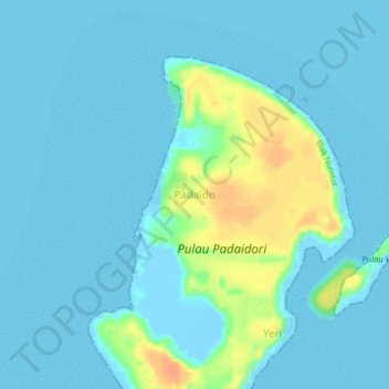
Name: Padaido topographic map, elevation, terrain.

Location: Padaido, Biak Kota, Papua, Western New Guinea, Indonesia (-1.16904 136.58379 -1.12904 136.62379)

Average elevation: 7 m

Minimum elevation: -8 m

Maximum elevation: 37 m

Other topographic maps

Click on a map to view its topography, its elevation and its terrain.

Gear up for your next adventure:

Camping Groundsheet - Protect your tent from moisture and dirt
💧Hydration Bladder - Hands-free hydration solution for long treks
🧦Hiking Socks - Moisture-wicking and comfortable socks for long hikes
🧰Multitool Knife - Compact and versatile tool for outdoor use
💡Solar Camping Lamp - Eco-friendly lighting for campsites

As an Amazon Associate, this site earns from qualifying purchases at no extra cost to you.