Geolocate

Palaran topographic map

Click on the map to display elevation.

About this map

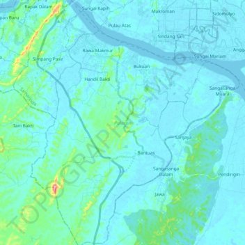
Name: Palaran topographic map, elevation, terrain.

Location: Palaran, Samarinda, East Kalimantan, Kalimantan, Indonesia (-0.71676 117.11336 -0.53109 117.28455)

Average elevation: 17 m

Minimum elevation: -3 m

Maximum elevation: 187 m

Gear up for your next adventure:

🧼Travel Hand Sanitizer - Keep hands clean when water is scarce
🔦LED Headlamp - Hands-free lighting for early morning starts or late finishes
🧭GPS Tracker - Track your location in remote areas safely
🥾Waterproof Hiking Boots - Essential footwear for rugged terrain and wet Canadian trails
👟Sport Hiking Sandals - Breathable footwear for water crossings and camp rest

As an Amazon Associate, this site earns from qualifying purchases at no extra cost to you.