
Thank you for supporting this site ❤️
Make a donation
Make a donation
Gear up for your next adventure:
As an Amazon Associate, this site earns from qualifying purchases at no extra cost to you.
Burneh topographic map
Click on the map to display elevation.
Thank you for supporting this site ❤️
Make a donation
Make a donation
Gear up for your next adventure:
As an Amazon Associate, this site earns from qualifying purchases at no extra cost to you.
About this map
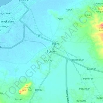
Name: Burneh topographic map, elevation, terrain.
Location: Burneh, Bangkalan, East Java, Java, 69116, Indonesia (-7.09299 112.74294 -7.01299 112.82294)
Average elevation: 13 m
Minimum elevation: -5 m
Maximum elevation: 101 m
Thank you for supporting this site ❤️
Make a donation
Make a donation
Gear up for your next adventure:
As an Amazon Associate, this site earns from qualifying purchases at no extra cost to you.