Geolocate

Lone Pine topographic map

Click on the map to display elevation.

About this map

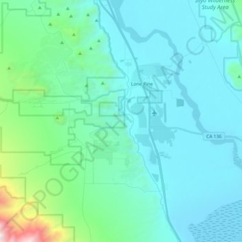
Name: Lone Pine topographic map, elevation, terrain.

Location: Lone Pine, Inyo County, California, 93545, United States (36.51271 -118.11607 36.65359 -118.04095)

Average elevation: 1,346 m

Minimum elevation: 1,084 m

Maximum elevation: 3,034 m

Gear up for your next adventure:

🥽Outdoor Goggles - Protective eyewear for outdoor activities
🕯️Camping Lantern - Illuminates your entire campsite with high-efficiency LEDs
🥾Light Trekking Boots - Supportive boots for multi-day treks
💧Reusable Water Bottle - Durable water bottles for hydration on trails
🧥Softshell Hiking Jacket - The perfect balance of wind protection and breathability

As an Amazon Associate, this site earns from qualifying purchases at no extra cost to you.