Geolocate

Franklin topographic map

Click on the map to display elevation.

About this map

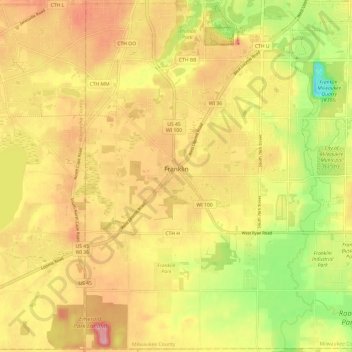
Name: Franklin topographic map, elevation, terrain.

Location: Franklin, Milwaukee County, Wisconsin, 53132, United States (42.84333 -88.06990 42.93040 -87.94938)

Average elevation: 234 m

Minimum elevation: 159 m

Maximum elevation: 291 m

Gear up for your next adventure:

🥘Camping Cookware Set - Compact nesting pots and pans for trail cooking
Bushcraft Tarp - Versatile emergency shelter or gear protection
🥾Lightweight Hiking Shoes - Comfortable shoes for day hikes
🔦LED Flashlight - Powerful and long-lasting flashlight for camping and emergencies
🥾Trail Running Shoes - Lightweight and durable shoes for trail running

As an Amazon Associate, this site earns from qualifying purchases at no extra cost to you.