
Thank you for supporting this site ❤️
Make a donation
Make a donation
Gear up for your next adventure:
As an Amazon Associate, this site earns from qualifying purchases at no extra cost to you.
Ponteceno topographic map
Click on the map to display elevation.
Thank you for supporting this site ❤️
Make a donation
Make a donation
Gear up for your next adventure:
As an Amazon Associate, this site earns from qualifying purchases at no extra cost to you.
About this map
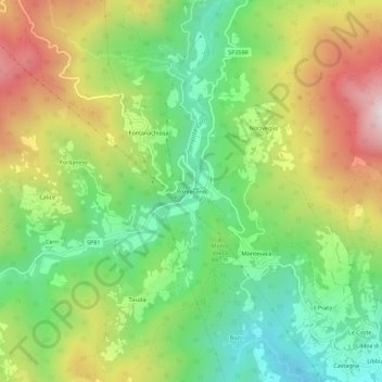
Name: Ponteceno topographic map, elevation, terrain.
Location: Ponteceno, Bedonia, Parma, Emilia-Romagna, 43041, Italia (44.52009 9.58253 44.56009 9.62253)
Average elevation: 863 m
Minimum elevation: 567 m
Maximum elevation: 1,288 m
Thank you for supporting this site ❤️
Make a donation
Make a donation
Gear up for your next adventure:
As an Amazon Associate, this site earns from qualifying purchases at no extra cost to you.