
Make a donation
Gear up for your next adventure:
As an Amazon Associate, this site earns from qualifying purchases at no extra cost to you.
Froschloch topographic map
Click on the map to display elevation.
Make a donation
Gear up for your next adventure:
As an Amazon Associate, this site earns from qualifying purchases at no extra cost to you.
About this map
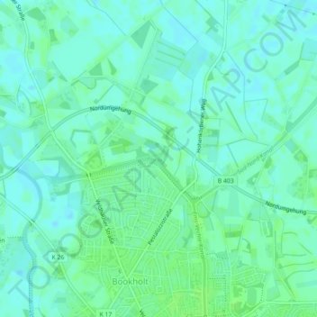
Name: Froschloch topographic map, elevation, terrain.
Average elevation: 22 m
Minimum elevation: 18 m
Maximum elevation: 26 m
Make a donation
Gear up for your next adventure:
As an Amazon Associate, this site earns from qualifying purchases at no extra cost to you.
Other topographic maps
Click on a map to view its topography, its elevation and its terrain.
Brandlecht
Deutschland > Niedersachsen > Landkreis Grafschaft Bentheim > Nordhorn
Average elevation: 28 m
Klausheide
Deutschland > Niedersachsen > Landkreis Grafschaft Bentheim > Nordhorn
Der zwischen 1914 und 1919 errichtete Gutshof steht mit allen Nebengebäuden und den ihn umgebenden Alleen unter Denkmalschutz. Die Gutsanlage gleicht einem großen Vierkanthof mit geschlossenem Innenbereich. Zusammen mit dem südlich gelegenen Park, durch den der rund 200 Meter lange Zufahrtsweg zum…
Average elevation: 25 m