Geolocate

Tyler Knob topographic map

Click on the map to display elevation.

About this map

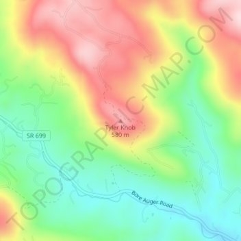
Name: Tyler Knob topographic map, elevation, terrain.

Location: Tyler Knob, Bedford County, Virginia, United States (37.33092 -79.75481 37.33102 -79.75471)

Average elevation: 429 m

Minimum elevation: 296 m

Maximum elevation: 597 m

Other topographic maps

Click on a map to view its topography, its elevation and its terrain.

Elk Creek

United States > Virginia > Bedford County

Average elevation: 220 m

Bedford

United States > Virginia > Bedford County

Average elevation: 285 m

Gear up for your next adventure:

🥾Lightweight Hiking Shoes - Comfortable shoes for day hikes
🛌Down Sleeping Bag - Superior warmth-to-weight ratio for cold nights
🧥Softshell Jacket - Windproof and breathable jacket for hiking
🔨Vehicle Emergency Tool - Safety tool for remote road trips to trailheads
🩹Moleskin Blister Pads - Direct protection for painful foot pressure points

As an Amazon Associate, this site earns from qualifying purchases at no extra cost to you.