Geolocate

Darbo topographic map

Click on the map to display elevation.

About this map

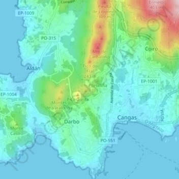
Name: Darbo topographic map, elevation, terrain.

Location: Darbo, Cangas, O Morrazo, Pontevedra, Galicia, 36949, Spain (42.24648 -8.81397 42.29905 -8.78139)

Average elevation: 71 m

Minimum elevation: -1 m

Maximum elevation: 405 m

Other topographic maps

Click on a map to view its topography, its elevation and its terrain.

Cangas

Spain > Galicia > O Morrazo > Cangas

Average elevation: 54 m

Gear up for your next adventure:

🧳Compression Sacks - Maximize space in your backpack by shrinking gear
🥾Trekking Boots - Durable boots for long-distance trekking
🥾Light Trekking Boots - Supportive boots for multi-day treks
🥾Lightweight Hiking Boots - Boots for comfort and mobility on long hikes
🔨Vehicle Emergency Tool - Safety tool for remote road trips to trailheads

As an Amazon Associate, this site earns from qualifying purchases at no extra cost to you.