Geolocate

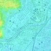
Rungkut topographic map

Click on the map to display elevation.

About this map

Name: Rungkut topographic map, elevation, terrain.

Location: Rungkut, Surabaya, East Java, Indonesia (-7.33501 112.75753 -7.29875 112.84534)

Average elevation: 3 m

Minimum elevation: -4 m

Maximum elevation: 8 m

Other topographic maps

Click on a map to view its topography, its elevation and its terrain.
Caribbean Island

Indonesia > East Java > Surabaya > Keputih

Average elevation: 0 m

Taman Harmoni

Indonesia > East Java > Surabaya

Average elevation: 2 m

Taman Flora

Indonesia > East Java > Surabaya > Baratajaya

Average elevation: 5 m

Taman Suroboyo

Indonesia > East Java > Surabaya

Average elevation: 1 m

Caribbean Island

Indonesia > East Java > Surabaya

Average elevation: 0 m

Canberra

Indonesia > East Java > Surabaya > Manukan Wetan

Average elevation: 4 m

Taman Pelangi

Indonesia > East Java > Surabaya > Gayungan

Average elevation: 6 m

Gear up for your next adventure:

🎒Hiking Backpack - Lightweight and ergonomic backpacks for day hikes or multi-day treks
🧣Evaporative Cooling Towel - Beat the heat during intense summer climbs
🧴Waterproofing Spray - Restore the DWR coating on jackets and tents
🥾Hiking Shorts - Breathable shorts suitable for summer hikes
🔦LED Headlamp - Hands-free lighting for early morning starts or late finishes

As an Amazon Associate, this site earns from qualifying purchases at no extra cost to you.