Geolocate

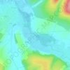
89800 topographic map

Click on the map to display elevation.

About this map

Name: 89800 topographic map, elevation, terrain.

Location: 89800, Chablis, Auxerre, Yonne, Bourgogne-Franche-Comté, France métropolitaine, France (47.69695 3.68748 47.89093 3.91100)

Average elevation: 219 m

Minimum elevation: 105 m

Maximum elevation: 348 m

Other topographic maps

Click on a map to view its topography, its elevation and its terrain.
Les Preuses

France > Bourgogne-Franche-Comté > Yonne > Chablis

Average elevation: 167 m

Ru de Crioux

France > Bourgogne-Franche-Comté > Yonne > Chablis

Average elevation: 156 m

Gear up for your next adventure:

🧥Softshell Jacket - Windproof and breathable jacket for hiking
🧦Crew Hiking Socks - Comfortable socks for long-distance hikes
🛌Down Sleeping Bag - Superior warmth-to-weight ratio for cold nights
🛁Quick-Dry Microfiber Towel - Space-saving towel that dries rapidly on the move
💡LED Headlamp - Hands-free illumination for night hiking and camping

As an Amazon Associate, this site earns from qualifying purchases at no extra cost to you.