
Thank you for supporting this site ❤️
Make a donation
Make a donation
Gear up for your next adventure:
As an Amazon Associate, this site earns from qualifying purchases at no extra cost to you.
Dunkeld topographic map
Click on the map to display elevation.
Thank you for supporting this site ❤️
Make a donation
Make a donation
Gear up for your next adventure:
As an Amazon Associate, this site earns from qualifying purchases at no extra cost to you.
About this map
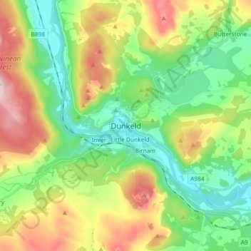
Name: Dunkeld topographic map, elevation, terrain.
Location: Dunkeld, Perth and Kinross, Scotland, PH8 0AL, United Kingdom (56.52557 -3.62625 56.60557 -3.54625)
Average elevation: 190 m
Minimum elevation: 36 m
Maximum elevation: 469 m
Thank you for supporting this site ❤️
Make a donation
Make a donation
Gear up for your next adventure:
As an Amazon Associate, this site earns from qualifying purchases at no extra cost to you.