Geolocate

Vagen topographic map

Click on the map to display elevation.

Vagen

Vagen ist ein Ortsteil der Gemeinde Feldkirchen-Westerham im Landkreis Rosenheim. Das Pfarrdorf liegt auf einer Höhe von 525,7 m ü. NN. Vor der Gemeindegebietsreform 1972 war Vagen eine eigenständige Gemeinde.

Wikipedia (CC-BY-SA 3.0)

About this map

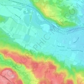
Name: Vagen topographic map, elevation, terrain.

Location: Vagen, Feldkirchen-Westerham, Landkreis Rosenheim, Bayern, 83620, Deutschland (47.85434 11.86175 47.89434 11.90175)

Average elevation: 564 m

Minimum elevation: 509 m

Maximum elevation: 679 m

Gear up for your next adventure:

🦯Trekking Poles - Reduced impact on joints for steep topographic climbs
🛌Down Sleeping Bag - Superior warmth-to-weight ratio for cold nights
🧊Portable Cooler - Keep food and drinks cold during outdoor adventures
🔦LED Flashlight - Powerful and long-lasting flashlight for camping and emergencies
🦌Outdoor Trail Camera - Monitor wildlife activity near your favorite spots

As an Amazon Associate, this site earns from qualifying purchases at no extra cost to you.