
Thank you for supporting this site ❤️
Make a donation
Make a donation
Gear up for your next adventure:
As an Amazon Associate, this site earns from qualifying purchases at no extra cost to you.
Çerçi topographic map
Click on the map to display elevation.
Thank you for supporting this site ❤️
Make a donation
Make a donation
Gear up for your next adventure:
As an Amazon Associate, this site earns from qualifying purchases at no extra cost to you.
About this map
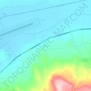
Name: Çerçi topographic map, elevation, terrain.
Location: Çerçi, Tokat Merkez, Tokat, Black Sea Region, Turkey (40.29936 36.39222 40.33936 36.43222)
Average elevation: 616 m
Minimum elevation: 564 m
Maximum elevation: 833 m
Thank you for supporting this site ❤️
Make a donation
Make a donation
Gear up for your next adventure:
As an Amazon Associate, this site earns from qualifying purchases at no extra cost to you.