Geolocate

Tres Esquinas topographic map

Click on the map to display elevation.

About this map

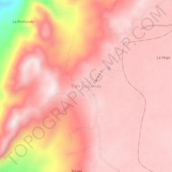
Name: Tres Esquinas topographic map, elevation, terrain.

Location: Tres Esquinas, Cunday, Oriente, Tolima, Colombia (3.84403 -74.73080 3.88403 -74.69080)

Average elevation: 1,085 m

Minimum elevation: 616 m

Maximum elevation: 1,210 m

Gear up for your next adventure:

🧶550 Survival Paracord - Versatile utility cord for emergency repairs and rigging
🚑Survival Whistle - Signal for help across long distances in mountains
🧢Sun Hat - Wide-brim hat for sun protection
🍽️Titanium Camping Spork - Ultralight and indestructible eating utensil
🔦LED Headlamp - Hands-free lighting for early morning starts or late finishes

As an Amazon Associate, this site earns from qualifying purchases at no extra cost to you.