Geolocate

Agua Zarca topographic map

Click on the map to display elevation.

About this map

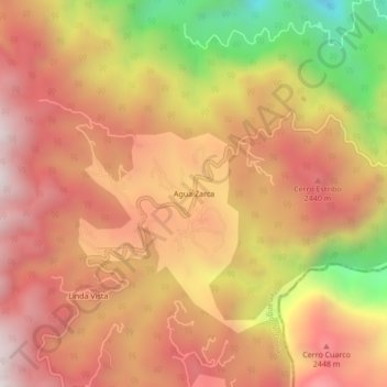
Name: Agua Zarca topographic map, elevation, terrain.

Location: Agua Zarca, Tenango de Doria, Hidalgo, Mexico (20.28917 -98.28694 20.32917 -98.24694)

Average elevation: 2,228 m

Minimum elevation: 1,489 m

Maximum elevation: 2,679 m

Gear up for your next adventure:

🥾Trail Running Boots - Durable shoes designed for trail running
🛶Kayak Dry Bag - Waterproof storage for kayaking adventures
🧢Outdoor Visor - Breathable visor for sunny hikes
🥾Light Trekking Boots - Supportive boots for multi-day treks
🧊Portable Cooler - Keep food and drinks cold during outdoor adventures

As an Amazon Associate, this site earns from qualifying purchases at no extra cost to you.